Do low traffic neighbourhoods offer a sustainable solution to reducing congestion and pollution in cities? Or are these restrictions detrimental to both locals and businesses? Katie Searles reports…
Low traffic neighbourhoods (LTNs) have been installed in various urban communities throughout the country for almost a year as councils attempt to encourage a sustainable recovery from the coronavirus pandemic. Whether it is a temporary widening of pavements to give pedestrians room to spread out, additional bike lanes to encourage cycling or larger projects to reroute road vehicles from residential streets, these trials are changing how people, goods and materials move through Britain’s cities.
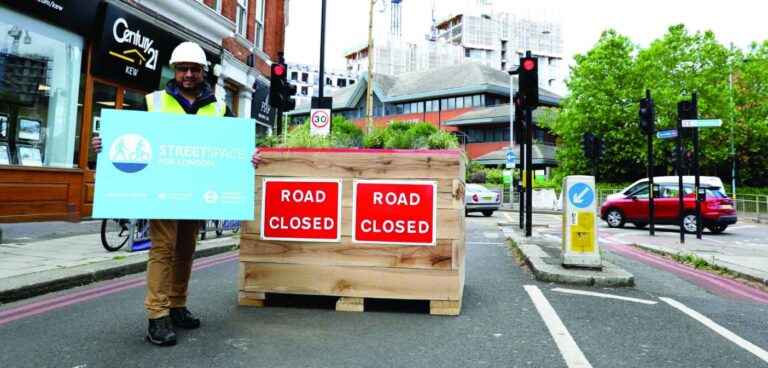
Some are part of wider local regeneration projects such as The Groves in York. In September 2020 all through routes were closed to traffic while cycling access remained. Planters were placed at the majority of the closure points, with parking spaces removed to allow for turning points.
These measures will be in place for up to 18 months as part of a two-year regeneration project. According to City of York Council, the introduction followed feedback from local people, who wanted less traffic and better air quality in and around York city centre.
“Our aim is to embed active travel – walking and cycling – as part of a long-term habit and reap the associated health, air quality and congestion benefits,” says councillor Andy D’Agorne, executive member for transport, City of York Council.
“Streets that are less congested or car dominated lead to much improved road safety, better air quality and more walking and cycling, which can improve health and wellbeing.”
Access all areas?
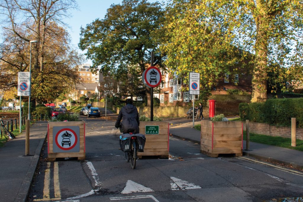
One reason for the introduction of LTNs is to deal with the issue of residential roads being used as shortcuts or ‘rat-running’, as John Galsworthy, assistant director parking at Hammersmith & Fulham Council, explains. “Demand on the strategic road network has increased significantly. It is a bit like a river that bursts its banks and floods off onto the sides. It is the same with road traffic, it flows off into side streets as it tries to get to its destination faster.”
This has prompted the London borough, which sees 92% of traffic in the area come from people who live outside the borough, to install nine Videalert CCTV enforcement camaras to monitor traffic and fine non-residents using SW6 streets.
As part of its Traffic Congestion and Air Pollution Reduction Zone, Hammersmith & Fulham Council is using ANPR technology to capture the number plates of vehicles that enter several highly congested streets. Data is transmitted from the cameras to Videalert’s hosted platform, which integrates with the council’s permit systems to ensure that resident and key ‘permitted vehicles’ can pass through control points and move around the area without obstacle.
Visitors and delivery drivers are accommodated within the scheme via a data push from the host system. Furthermore, the hosted platform maintains an ‘exempt list’ of permitted vehicles including buses, taxis, emergency services, refuse trucks and council service vehicles.
By using enforcement cameras, there is no need for physical obstructions such as the planters used in other LTN areas. It is this use of technology that makes the London borough’s traffic congestion and air pollution reduction programme different.
Galsworthy says that the cameras are used to “try and fend off the technology war that is happening because of satellite navigation, which makes a lot of the older types of traffic reduction schemes redundant.
“We are the first to use camera-enforced gateways, it is almost like a virtual gated community to some extent. The residents can control who is given access through the cameras and they can do that by booking parking slots on pay-by-phone-apps.”
The use of camera technology effectively leaves the road network through this particular zone as it was previously, with no filters controlling traffic. Galsworthy explains: “It has less impact on the local residents in their daily lives. It also improves access for emergency services.
“Where the main roads they would normally use were all gridlocked, they now have these free routes to use and navigate around. The bigger we can build these networks the faster we can build new, quicker emergency routes for them because we can keep areas clear.”
According to Galsworthy, Hammersmith & Fulham Council anticipates the scheme will significantly reduce, and in some instances eliminate, through traffic in the borough, helping to reduce noise, air pollution and vehicle emissions in line with the council’s climate emergency strategy.
Route of the problem
The issue of rat-running would once have been a problem limited to those aware of such short cuts. However, as many vehicles now feature infotainment systems or mobile route planning applications, traffic is now algorithmically sent via the quickest and shortest way.
Galsworthy says: “Satellite navigation has probably had the biggest influence on increasing traffic congestion in residential areas because it actively routes people through residential streets to get to locations faster. If it is one minute quicker to go through a residential street it will take it.”
He is not alone in his concerns. In November 2020 London Borough of Hackney cabinet member for transport Jon Burke took to twitter to have his say: “Google bought Waze for a billion dollars. This company’s value was built on turning our neighbourhoods into giant bypasses. If you oppose low traffic neighbourhoods, you’re defending the right of Silicon Valley billionaires to plunder our cities.”
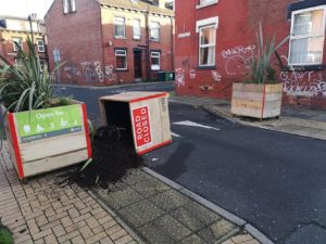
However, the use of technology such as that used by Hammersmith & Fulham Council may actually help LTNs overcome other issues, such as vandalism, which has plagued one particular LTN trial in Leeds. Whilst planters have been used in several schemes in the city, they have not all been welcomed additions.
In the Leeds Hyde Park trial, planters have been subject to vandalism and there have been reports of cars mounting the pavement to get round planters located at Royal Park Road.
Such negative response to LTNs is also impacting on the schemes themselves. Two roads that were closed as part of Leeds’ LTN were reopened in December 2020 following a local campaign. The closures at Royal Park Road and Alexandra Road were removed and the remainder of the trial is expected to continue for its allotted six-month period.
A spokesperson for Leeds City Council says: “We would like to thank people who have responded directly to the consultation and provided their views on our active travel neighbourhoods. We promised to listen closely to local residents and their experiences, the positives and the negatives while they are in place.
“After reviewing the Hyde Park low traffic neighbourhood, we’re going to make some changes to two roads in the scheme. Local ward councillors want to work with residents on shared concerns about road safety.”
Bad for business
Elsewhere, a LTN in Wandsworth, southwest London, has been shelved following negative feedback from both residents and local businesses. In September 2020, councillors met with local business owners worried about measures introduced on the Upper Tooting Road by Transport for London (TfL).
According to Wandsworth Council, businesses were concerned that a reduction in customer parking would have a negative impact on their livelihoods, with people choosing to shop elsewhere.
Wandsworth Council’s cabinet member for strategic planning and transportation, councillor John Locker, says: “It is clear that the LTNs are not delivering the benefits we want to see. In fact it looks like the combination of changes in areas like Tooting, where TfL are making changes to the main high road, are unfortunately having the opposite effect.
“That is why we have taken the difficult decision to pause and re-think about how we can achieve our objective of delivering healthier, safer streets.”
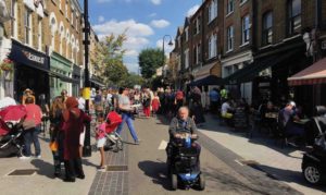
So, whilst LTNs have not been met with universal acclaim, one promise from all councils involved in such schemes is that public consultations will run for the duration of the trials. What’s more, the temporary nature of some of the infrastructure installed means it can be moved, altered and even removed entirely.
Additionally, the use of data from location-based data companies, such as Inrix, will be monitored to analyse how these areas are affecting traffic as a whole.
Whilst the success of such schemes on reducing congestion and improving air quality has yet to be determined, Galsworthy suggests that, for these schemes to progress, there needs to be a local consensus and the public needs to be involved in the journey. “People need to understand that the whole purpose of low traffic neighbourhoods is not to prevent access or to stop people from being able to drive in them.
“The whole purpose of low traffic neighbourhoods is to stop people using them as main roads. It is a bit of a myth, or a misnomer, that these schemes ruin access for local people or harm local businesses. It is actually the reverse.”
Bolstered Bee network
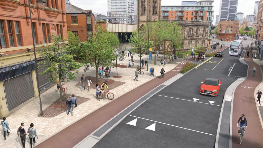
Simply banning cars from accessing residential streets is in itself likely not enough to lower emissions and reduce congestion in urban areas. This is why Greater Manchester is ploughing £16m of funding to add 24 miles of permanent active travel routes to its Bee Network.The investment will allow Transport for Great Manchester to deliver a total of 55 miles of permanent cycling and walking routes by the end of the year. “The first round of government funding back in July gave us the chance to trial cycling and walking routes, a try-before-you-buy experience,” says Greater Manchester’s cycling and walking commissioner, Chris Boardman.
“This latest funding will not only allow us to continue to do that, but to deliver permanent measures that will enable people to make the change long term, intrinsically linked to our plans to deliver the Bee Network – the UK’s largest cycling and walking network. We will be consulting and engaging extensively with residents to ensure we get the locations right and let them tell us where routes are needed the most.
“By giving more people the choice to walk or ride to shops and school for those shorter local journeys, we can change travel habits for good, improve our health, clean up the air and, ultimately, make us happier. The award also shows the confidence government has in the people of Greater Manchester to lead the way in creating an example for the rest of the UK, something everyone in Greater Manchester should be very proud of.”
The funding will enable 25 schemes to be delivered across all 10 Greater Manchester councils to provide safe travel options for the third of Greater Manchester residents who do not have access to a car.
Mayor of Greater Manchester, Andy Burnham, says: “[The network] will reduce congestion and air pollution on our roads, making our streets nicer places to be on foot and by bike, and moving us a step closer to a truly integrated transport system.
“I must champion the tireless efforts of our local authorities to develop and now deliver these schemes. It’s a huge vote of confidence that national government gave us more money than we originally asked for. They clearly see great value in our ambitious plans to make Greater Manchester a true cycling and walking region.”
This article originally appeared in the February 2021 issue of CiTTi Magazine

